HELIOS++ - Heidelberg LiDAR Operations Simulator
HELIOS++ is hosted on GitHub with an extensive wiki.
News
Stay up-to-date by following HELIOS via our GIScience News Blog and on Bluesky and LinkedIn: #HELIOS #3DGeo.
New release: HELIOS++ v2.0.0.
From this version on, HELIOS++ is on Conda-forge and can be installed with:
conda install -c conda-forge helios
or
mamba install -c conda-forge helios
Check out our Blogpost.

Successful proposal: Fostering a community-driven and sustainable HELIOS++ scientific software: The 3DGeo Group and the Scientific Software Center (SSC) of Heidelberg University have been successful with their proposal in the DFG call “Research Software – Quality assured and re-usable”. The main objective of the new project is to bring HELIOS++ to a professional level of software development and quality and to establish sustainable institutional structures (see press release)

General Information
In 2020, HELIOS++ replaced the former version of HELIOS with a modern implementation in C++11, including Python bindings to allow easy use in existing workflows. The code and ready-for-use precompiled versions are hosted on GitHub. We invite interested researchers and developers to contribute to further development of this project by submitting pull requests. We also host an extensive wiki, where the complete functionality of HELIOS++ is documented.
Literature & How to cite HELIOS++
More information on HELIOS++ is available in our publication. If you use HELIOS++ in your work, please cite:
- Winiwarter, L., Esmorís Pena, A., Weiser, H., Anders, K., Martínez Sanchez, J., Searle, M., Höfle, B. (2022): Virtual laser scanning with HELIOS++: A novel take on ray tracing-based simulation of topographic full-waveform 3D laser scanning. Remote Sensing of Environment. Vol. 269. DOI: 10.1016/j.rse.2021.112772
Citation as BibTex:
@article{heliosPlusPlus,
title = {Virtual laser scanning with HELIOS++:
A novel take on ray tracing-based simulation
of topographic full-waveform 3D laser scanning},
journal = {Remote Sensing of Environment},
volume = {269},
year = {2022},
issn = {0034-4257},
doi = {https://doi.org/10.1016/j.rse.2021.112772},
author = {Lukas Winiwarter and Alberto Manuel {Esmorís Pena}
and Hannah Weiser and Katharina Anders
and Jorge {Martínez Sánchez} and Mark Searle and Bernhard Höfle}
}
Secondary paper on virtual laser scanning simulation with HELIOS++ as a high performance computing challenge:
- Esmorís, A. M., Yermo, M., Weiser, H., Winiwarter, L., Höfle, B. & Rivera, F.F. (2022): Virtual LiDAR simulation as a high performance computing challenge: Towards HPC HELIOS++. IEEE Access 10, pp. 105052-105073. DOI: 10.1109/ACCESS.2022.3211072.
Research
HELIOS++ and its predecessor have been used extensively in different research:
Winiwarter et al. (2022) conducted a systematic literature review based on these publications (see above).
Background
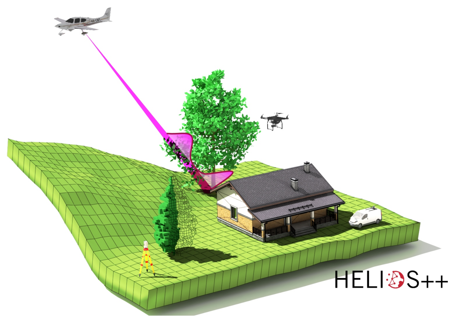
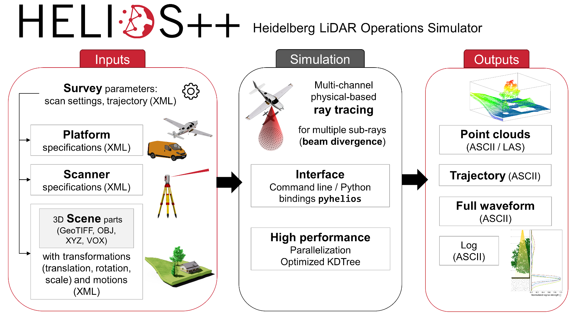
Virtual laser scanning is a tool to create simulated point cloud data, as would be acquired by a LiDAR sensor. Such data may be used to complement real data, where data acquisition is not feasible due to economical or logistic constraints or where it is impossible, e.g. when simulating a sensor that does not exist. HELIOS++ allows the simulation of laser scanning on different platforms (airborne, UAV-based, terrestrial mobile and static) and using different data types to represent the 3D scene, including triangular meshes, digital elevation rasters, voxel grids and point clouds. The implementation in C++ allows for low runtimes and efficient memory usage, while the Python bindings pyhelios enable direct use of HELIOS++ from within Python scripts.

HELIOS++ software modules (platform, scanner, scene, survey) and LiDAR simulation sequence.
Outreach
At the 2022 FOSSGISS conference on free open source software for geographic information systems, we presented AEOS, the QGIS Plugin that enables the usage of HELIOS++ in one of the most widely used GIS applications. Check out the demo session here and learn how to simulate your own point clouds!
Projects using HELIOS++

We investigate the close coupling of learning algorithms with virtual laser scanning and real point cloud data to use benefits of both 1) the realism of real − but sparse − training data and 2) the multitude of options of object-sensor interactions that can be generated with VLS.

SYSSIFOSS - Synthetic structural remote sensing data for improved forest inventory models
LOKI - Airborne Observation of Critical Infrastructure


